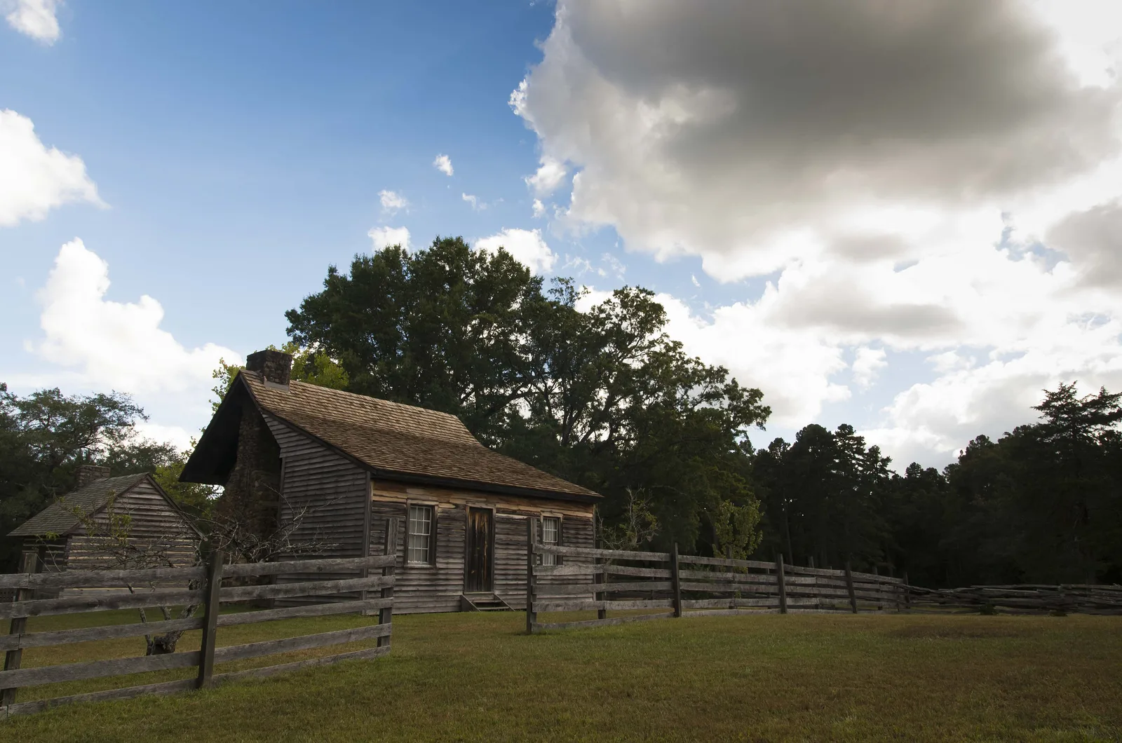
Durham grew around an 1850s rail depot and was incorporated April 10, 1869. Its 75 National Register listings, museums and historic sites, with hours.
Last checked Oct. 11, 2026. Facts on this page come from Discover Durham’s history of the city, NCpedia (the State Library of North Carolina), the National Park Service’s National Register of Historic Places data, the City of Durham and N.C. Historic Sites.
Durham began as a railroad stop. In the mid-1840s Dr. Bartlett Durham bought 100 acres near the Hillsborough-Raleigh road and granted a 4-acre right-of-way for a railroad track and depot, according to Discover Durham; the station stood near today’s Pettigrew and Corcoran streets. As the settlement around Durham Station grew, the General Assembly incorporated the city on April 10, 1869. Durham was then part of Orange County; Durham County was created in 1881 from Orange and Wake counties, NCpedia says.
Visit
- Museum of Durham History: 500 W. Main St.; 10 a.m. to 5 p.m. Tuesday through Saturday and noon to 5 p.m. Sunday; free
- Bennett Place State Historic Site: 4409 Bennett Memorial Road
- Duke Homestead State Historic Site: 2828 Duke Homestead Road
- Historic Stagville: 5828 Old Oxford Highway
- The three state sites are open 9 a.m. to 5 p.m. Tuesday through Saturday, closed Sunday, Monday and state holidays; admission is free, with fees for some tours and events.
A short history
- Before the railroad: the Occaneechi and Eno lived along a Native American trading route through the area, NCpedia says. Large plantations, including Stagville, grew up before the Civil War, worked by enslaved people.
- April 1865: at James and Nancy Bennett’s farmhouse, Gen. Joseph E. Johnston surrendered the Confederate armies in the Carolinas, Georgia and Florida to Gen. William T. Sherman, the largest troop surrender of the Civil War.
- Tobacco: after the war, Washington Duke’s family built a tobacco business that moved downtown in 1874. J.B. Duke founded the American Tobacco Company in 1890. The city’s nickname, the Bull City, comes from the Durham bull that advertised Bull Durham tobacco.
- Education: Trinity College moved to Durham in 1892 and became Duke University in 1924. Dr. James E. Shepard opened the school that became North Carolina Central University in 1910.
- Black Wall Street: John Merrick founded North Carolina Mutual Life Insurance Co. in 1898, and Mechanics and Farmers Bank opened in 1907.
- Civil rights: in 1957 six African Americans sought service at the segregated Royal Ice Cream Parlor, three years before the Greensboro sit-ins. Urban renewal from 1958 cleared much of the Hayti community for the Durham Freeway.
- Research Triangle Park was founded in 1959 in southern Durham County.
Historic districts
The city and county have eight local historic districts, where exterior changes need a Certificate of Appropriateness: Cleveland Street, Downtown Durham, Fayetteville Street, Golden Belt, Holloway Street, Morehead Hill, Trinity Heights and Watts-Hillandale. Their preservation plans are on the city’s local historic districts page.
National Register of Historic Places
The National Park Service’s data lists 70 properties and districts with a Durham address, from the Bull Durham Tobacco Factory in 1974 to the Harriet Tubman YWCA and the West End Cemeteries Historic District in 2024. Boundary increases to existing districts appear as separate entries. For nominations and tax credits, call the State Historic Preservation Office at 919-807-6570.
| Year listed | Property | Address or location |
|---|---|---|
| 1970 | Bennett Place State Historic Site | Jct. of SR 1313 and 1314 |
| 1974 | Bull Durham Tobacco Factory (National Historic Landmark) | 201 W. Pettigrew St. |
| 1975 | North Carolina Mutual Life Insurance Company Building (National Historic Landmark) | 114-116 W. Parrish St. |
| 1976 | St. Joseph’s African Methodist Episcopal Church | Fayetteville St. and Durham Expwy. |
| 1977 | Downtown Durham Historic District | Roughly bounded by Peabody, Morgan, Seminary, Cleveland, Parrish, and Queen Sts. |
| 1978 | John Sprunt Hill House | 900 S. Duke St. |
| 1978 | Durham Hosiery Mill | Angier Ave. |
| 1979 | Dillard-Gamble Houses | 1311 and 1307 N. Mangum St. |
| 1979 | Bassett House | 1017 W. Trinity Ave. |
| 1979 | Cranford-Wannamaker House | 1019 W. Trinity Ave. |
| 1979 | Crowell House | 504 Watts St. |
| 1979 | Pegram House | 1019 Minerva Ave. |
| 1980 | Watts Hospital | Broad St. and Club Blvd. |
| 1982 | Greystone | 618 Morehead Ave. |
| 1982 | Bullington Warehouse | 500 N. Duke St. |
| 1984 | Watts and Yuille Warehouses | 905 W. Main St. |
| 1984 | Erwin Cotton Mills Company Mill No. 1 Headquarters Building | W. Main and 9th Sts. |
| 1985 | North Durham-Duke Park District | Roughly bounded by Glendale Ave., W. Knox St., Roxboro Rd., Trinity Ave., Mangum & Broadway Sts. |
| 1985 | Duke Memorial United Methodist Church | 504 W. Chapel Hill St. |
| 1985 | Durham Cotton Mills Village Historic District | Roughly bounded by Byrd and Middle Sts., E. Frontage Rd. and Reservoir St. |
| 1985 | Emmanuel AME Church | 710 Kent St. |
| 1985 | Ephphatha Church | 220 W. Geer St. |
| 1985 | Golden Belt Historic District | Roughly bounded by N & W RR, Taylor, Holman Sts., Morning Glory Ave. and Main St. |
| 1985 | Morehead Hill Historic District | 803 & 807 Vickers Ave. |
| 1985 | William Thomas O’Brien House | 820 Wilkerson Ave. |
| 1985 | Pearl Mill Village Historic District | 900 Blk. of Washington and Orient Sts. between Trinity and Dacien Aves. |
| 1985 | Powe House | 1503 W. Pettigrew St. |
| 1985 | Scarborough House | 1406 Fayetteville St. |
| 1985 | Venable Tobacco Company Warehouse | 302-304 E. Pettigrew St. |
| 1985 | West Point on the Eno | Roxboro Rd. |
| 1985 | Cleveland Street District | Roughly Cleveland St. between Seminary & Gray Aves. & Mallard St. |
| 1985 | Holloway Street District | Roughly bounded by Holloway, Railroad & Liberty Sts., Peachtree Pl. & Dillard St. |
| 1985 | Smith Warehouse | 100 N. Buchanan Blvd. |
| 1985 | Durham Hosiery Mills No. 2-Service Printing Company Building | 504 E. Pettigrew St. |
| 1986 | Clyde R. Hoey Administration Building | Bounded by Lawson St., Alston Ave., Nelson, and Fayette Sts. |
| 1986 | Trinity Historic District | Roughly bounded by Green, Duke, Morgan and W. Main Sts. and Markham Ave., and Clarendon St. |
| 1986 | West Durham Historic District | Roughly bounded by Knox, Ninth, W. Main Sts., and Rutherford St. and Carolina Ave. |
| 1989 | Bartlett Mangum House | 2701 Chapel Hill Rd. |
| 1990 | Richard D. Blacknall House | 300 Alexander Ave. |
| 1996 | Golden Belt Historic District (Boundary Increase) | 1000-1004 E. Main St. |
| 1998 | North Durham County Prison Camp (Former) | 2410 Broad St. |
| 1999 | Bright Leaf Historic District | Roughly bounded by W. Peabody St., Duke St., Minerva Ave., N&W RR, Corporation St., Ligget St., Morris St. and W. Loop |
| 2000 | City Garage Yard and Fire Drill Tower | 501 Washington St. |
| 2000 | Clark and Sorrell Garage | 323 Foster St. |
| 2000 | American Tobacco Company Manufacturing Plant | Roughly bounded by W. Pettigrew St., Blackwell St., Willard St. and Carr St. |
| 2001 | Watts-Hillandale Historic District | Roughly bounded by Durham Waterworks, Wilson St., Sprunt Ave., Broad St., Englewood Ave., and Hillsborough Rd. |
| 2003 | Lakewood Park Historic District | 1601-1907 W. Lakewood Ave., 2001-2112 Chapel Hill Rd., 1406-1601 James St. and 1809-1819 Bivins St. |
| 2003 | Venable Tobacco Company Prizery and Receiving Room | 302-04 E. Pettigrew St. |
| 2004 | Morehead Hill Historic District (Boundary Increase) | Includes portions of Arnette, Vickers, Yancey, Parker and Wells Sts. |
| 2004 | Trinity Historic District (Boundary Increase) | Roughly bounded by Trinity Historic District, N. Buchanan Blvd., W. Club Blvd., Woodland Dr., and N. Duke St. |
| 2004 | East Durham Historic District | Roughly bounded by Southern Rwy right-of-way, N. Guthrie Ave. Holloway St., Hyde Park Ave, S. Plum St. and Vale St. |
| 2005 | Wiley and Elizabeth Forbus House | 3307 Devon Rd. |
| 2005 | Forest Hills Historic District | Roughly bounded by Kent St., Bivins St., Wells St., American Tobacco Trail, Forestwood Dr. and Beverly Dr. |
| 2008 | Trinity Historic District (Boundary Increase II) | 209-215 N Gregson St. |
| 2008 | Kinchen Holloway House | 4418 Guess Rd. |
| 2008 | Liberty Warehouse Nos. 1 and 2 | 611-613 Rigsbee Ave. |
| 2009 | Holloway Street Historic District (Boundary Increase) | Roughly bounded by Holloway, Elizabeth, Primitive, and Queen Sts., and Mallard Ave. |
| 2009 | Hope Valley Historic District | Avon Rd., Chelsea Circle, Cornwall Rd., Devon Rd. Exeter Way, Littlewoods Ln., Norwich Way, Stratford Rd. |
| 2010 | Burch Avenue Historic District | Roughly bounded by S Buchanan Blvd, W Chapel Hill St, Duke University Rd, Burch Ave, and Rome Ave |
| 2010 | Stokesdale Historic District | Roughly bounded by Fayetteville St, Umstead St, Lawson St, Moline St, Concord St, and Dunstan St |
| 2011 | John C. and Binford Carr House | 3400 Westover Rd. |
| 2012 | Scott and Roberts Dry Cleaning Plant, Office, and Store | 733 Foster St. |
| 2012 | Wright’s Automatic Machinery Company | 915 Holloway St. |
| 2013 | Mary Duke Biddle Estate | 1044 & 1050 W. Forest Hills Blvd. |
| 2013 | Foster and West Geer Streets Historic District | Bounded by W. Corporation, Madison & Washington Sts., Rigsbee Ave., N&SRR tracks, 724 & 733 Foster St. |
| 2013 | Hillside Park High School | 200 E. Umstead St. |
| 2014 | Durham Hosiery Mills Dye House | 708-710 Gilbert St. |
| 2019 | College Heights Historic District | Roughly bounded by Masondale & Formosa Aves., Fayetteville, Cecil & Nelson Sts. |
| 2024 | West End Cemeteries Historic District | 1000-1800 Morehead Avenue |
| 2024 | Harriet Tubman YWCA | 312 East Umstead Street |
Five more listings sit just outside the city: the Duke Homestead and Tobacco Factory (1966, a National Historic Landmark), Fairntosh Plantation and Stagville (both 1973), the Horton Grove Complex (1978) and Russell School (2009).
Cemeteries
- Maplewood Cemetery, 1621 Duke University Road, founded by the city in 1872, covers 120 acres and holds the graves of the Washington Duke family.
- Beechwood Cemetery, 3300 Fayetteville St., next to White Rock Baptist Church, founded in 1924, honors Black leaders including John Merrick.
- City cemeteries office: 919-560-4197, ext. 21245.
What this means for you
- All three state historic sites are free; pick a Saturday and see Bennett Place, the Duke Homestead and Stagville in a day.
- Own a home in a local historic district? Get a Certificate of Appropriateness before exterior work.
- Start at the Museum of Durham History downtown; it is free.
More: population and growth, parks and trails and things to do this month.
Frequently asked questions
When was Durham, NC founded?
Durham grew up around a railroad depot on land Dr. Bartlett Durham provided in the 1850s. The General Assembly incorporated it on April 10, 1869, and Durham County was created in 1881 from Orange and Wake counties.
Why is Durham called the Bull City?
The nickname comes from tobacco: a Durham bull became the advertising emblem of Bull Durham tobacco, made in the city, according to NCpedia.
How many National Register of Historic Places listings does Durham have?
The National Park Service’s National Register data lists 70 properties and districts with a Durham address, plus five more just outside the city, including the Duke Homestead and Stagville.
What historic sites can you visit in Durham?
Bennett Place, Duke Homestead and Historic Stagville are state historic sites open 9 a.m. to 5 p.m. Tuesday through Saturday with free admission. The Museum of Durham History at 500 W. Main St. is free and open Tuesday through Sunday.
Have your say