Hayti, just south of downtown along Fayetteville Street, is in ZIP codes 27701 and 27707. Its school zones split three ways.
Last checked Oct. 12, 2026. Sources: the City of Durham’s Durham Comprehensive Plan and planning GIS data, Durham Public Schools’ 2026-27 attendance zones, the N.C. Department of Public Instruction’s 2025-26 accountability data, NCDOT’s highway exit data, OpenStreetMap and Zillow Research.
Hayti is the neighborhood just south of downtown, across the Durham Freeway, around Fayetteville Street. OpenStreetMap names it as a place, and the city’s comprehensive plan tells part of its story: “Government officials decided to build a freeway through the thriving Black neighborhood of Hayti,” and the plan says Highway 147 now runs “where homes and businesses once stood.” Hayti is split between ZIP codes 27701 and 27707.
What this means for you
- Zoned high school: split among C.E. Jordan High (57.9% of state tests at grade level in 2025-26), Riverside High (47.5%) and Hillside High (41.2%). Check an address with the city’s school locator.
- Home value: $421,664 in ZIP code 27701 and $406,475 in 27707 in August 2026, according to the Zillow Home Value Index.
- Nearest freeway exit: Durham Freeway (N.C. 147) Exit 12B, Mangum and Roxboro streets, about 0.1 mile by road.
Part of our Durham neighborhoods guide.
Where it is
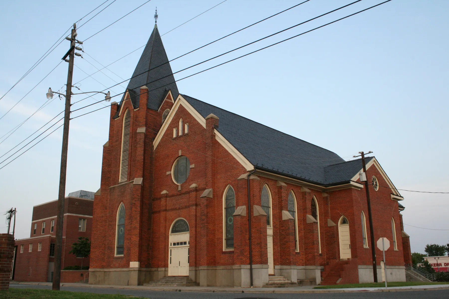
Neither the city nor the county publishes a boundary for Hayti, so for this page we used the area within about 0.4 mile of the point OpenStreetMap marks as Hayti, about 0.5 square mile. At that point stands St. Joseph’s AME Church, an “1890s Gothic Revival brick church” listed on the National Register of Historic Places in 1976, according to the city’s historic district and landmark data.
South along Fayetteville Street are the city’s Fayetteville Street local historic district, adopted by ordinance in 2000, and the National Register’s Stokesdale and College View historic districts, both described as African American residential neighborhoods. In a local historic district, state law requires a certificate of appropriateness before most exterior changes. The city’s Place Type Map marks the area as a mix of Established Residential, Downtown at the north end, and Apartment and Townhouse Neighborhood land.
Schools
Hayti is in Durham Public Schools, and its zones split more than any other area in this guide. We checked 448 points in the area against the 2026-27 attendance zones:
- High school: C.E. Jordan High about 40%, Riverside High 35%, Hillside High 25%.
- Middle school: Brogden 35%, Githens 29%, Shepard 25%, Lakewood 11%.
- Elementary school: C.C. Spaulding 29%, Fayetteville Street 25%, George Watts 18%, Eastway 17%, Morehead 11%.
| Level | School | At grade level | Growth |
|---|---|---|---|
| Elementary | C.C. Spaulding Elementary, 1531 S. Roxboro St. | 48.7% | Exceeded |
| Elementary | Fayetteville Street Elementary, 2905 Fayetteville St. | 45.3% | Met |
| Middle | Shepard Middle, 2401 Dakota St. | 52% | Exceeded |
| High | C.E. Jordan High, 6806 Garrett Road | 57.9% | Met |
| High | Riverside High, 3218 Rose of Sharon Road | 47.5% | Met |
| High | Hillside High, 3727 Fayetteville St. | 41.2% | Met |
“At grade level” is the share of state tests at grade level or above in 2025-26, from the state’s accountability data; the district figure was 53.2%. The other schools are on our Downtown and Forest Hills pages. Check your own address in the school locator or call the Office of Student Assignment at 919-560-2059. More in our schools guide.
Home values
Zillow publishes no figure for Hayti alone. The Zillow Home Value Index is a modeled typical value for the middle third of homes, not a sale price.
| Area | August 2026 | August 2025 | Change |
|---|---|---|---|
| ZIP code 27701 | $421,664 | $423,900 | -0.5% |
| ZIP code 27707 | $406,475 | $419,519 | -3.1% |
| City of Durham, for comparison | $389,634 | $403,339 | -3.4% |
Trends are on our home prices page.
Parks and trails
From the city’s park data and Durham Parks and Recreation:
- Hillside Park, 1301 S. Roxboro St., 13.9 acres with a pool, an amphitheater and a futsal court.
- Edgemont Park, 205 S. Elm St., with outdoor fitness equipment.
- Grant Street Park, 918 Grant St.
- Orchard Park, 1000 S. Duke St., about a quarter mile west.
- The American Tobacco Trail and the North/South Greenway pass through the area, according to OpenStreetMap.
More in our parks and trails guide and walking and biking trails guide.
Getting around
- Durham Freeway (N.C. 147): Exit 12B (U.S. 15 and U.S. 501 Business, Mangum and Roxboro streets) is about 0.1 mile by road from the middle of Hayti, Exit 11 (N.C. 55, Alston Avenue) about 0.6 mile and Exit 12A (Fayetteville Street, N.C. Central University) about 1.3 miles. Exit names are NCDOT’s.
- City Hall (101 City Hall Plaza): about 0.7 mile by road.
- Raleigh-Durham International Airport: about 13.7 miles by road.
- Buses: GoDurham Routes 7 and 8 stop on South Roxboro Street, and Routes 2, 3, 12, 13 and 16 stop at the area’s north and east edges, according to the city’s bus stop data. See GoDurham.
Distances were measured with the OSRM routing engine on OpenStreetMap roads from the point OpenStreetMap marks as Hayti. They are distances, not drive times. More in our getting around guide.
Groceries and everyday stores
OpenStreetMap lists these within about a mile:
- Supermarket: Compare Foods, 1233 University Drive.
- Pharmacy: Walgreens, 710 Fayetteville St.
- Library: the Durham County Library’s Stanford L. Warren Branch, 1201 Fayetteville St.
- Shopping: Forest Hills Shopping Center, about 0.7 mile southwest.
How we built this page
Hayti has no official boundary in city or county data, so the area is a circle of about 0.4 mile around the OpenStreetMap point; the comprehensive plan names the neighborhood. School zones come from the district’s 2026-27 attendance zones, checked at 448 points; a home near a zone line can differ. We found no city or county registry of homeowners associations for Hayti, so this page does not describe them.
Frequently asked questions
What high school is Hayti in Durham zoned for?
It depends on the street. In Durham Public Schools’ 2026-27 zones, about 40% of the area around Hayti is zoned for C.E. Jordan High, 35% for Riverside High and 25% for Hillside High. Check the exact address in the city’s school locator.
What ZIP code is Hayti in?
About two-thirds of the area around Hayti is in ZIP code 27701 and the rest, to the south and west, in 27707.
What does Durham’s comprehensive plan say about Hayti?
The 2023 plan says government officials decided to build a freeway through what it calls the thriving Black neighborhood of Hayti, and that Highway 147 now runs where homes and businesses once stood.
How far is Hayti from downtown Durham?
About 0.7 mile by road from the middle of Hayti to City Hall, measured on OpenStreetMap roads.
Have your say